Piteå
You leave Piteå behind after a couple of days on the beach. This is a real summer town, and Pite Havsbad is Sweden’s largest camping site with full services, mostly known for its long sandy beaches and a warm sea. You eat well and live the simple life, enjoying Piteå’s small town charm. The next restaurant or watering hole is always just around the corner. Hotel Kust with its roof terrace, spa and pool is a building that stands out in the townscape. The classic hotel Stadshotellet is newly renovated, Pensionatet offers a pleasant environment and tasty pizza, while restaurant Tage, Ångbryggeriet and Centrum Krog know how to handle a grill.
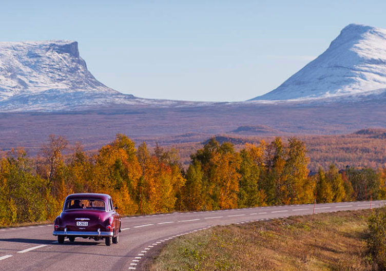
From Piteå to Kvikkjokk
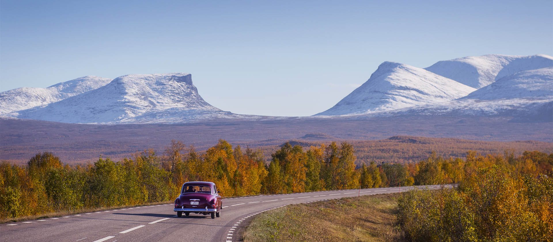
Along the Midnight Sun Road, from Piteå in the east, past the mighty waters of the Storforsen rapids, to Kvikkjokk in the west – and everything in between.
Click on [ ] to bring up the map on your mobile or desktop (at the top right corner of the map).
1. Piteå–Älvsbyn: 53 km
Route 374 west follows the Pite River. In Öjebyn, at the Housekeeping Society’s facilities, research is done into everything from biodynamic pest control to bubble making according to the champagne method, and the best field mustard. There’s also a Paltzeria here serving up the classic potato dumpling ‘Pitepalt’, which is taken very seriously at this latitude. You could also opt for a route through the ‘northern villages’, a small detour in terms of distance and in summer there’s a lot to discover along the way. If you want to live and experience the countryside both Jössgården and Västi Gård are great options. In Arnemark you’ll see a sign that says ‘Köttservice’, which is where you can buy the local meat you’ve been enjoying in town. The trail Solanderleden meanders through the pine forest next to the road. In Sikfors there’s another camping site, Sikfors Camping, where you could spend the night, but instead you keep going, further inland.
Also read
Via Solanderleden
The entire route
The entire route, from Piteå in the east to Kvikkjokk in the west, is 305 km. The trip takes you from the coastal town Piteå at the mouth of the Pite River to the mountain village Kvikkjokk at the shores of lake Saggat. The idea, of course, is for you to travel at your own pace and as you see fit. Here are some ideas along the way.
2. Älvsbyn–Storforsen: 48 km
It’s impossible to miss the mountain Hundberget when you approach Älvsbyn. It makes quite an impression. Älvsbyn is home to two of Norrbotten’s most prominent companies: Älvsbyhus, making houses, and Polarbröd, baking bread. The latter provides you with a well-deserved snack as you sit down to take in the view from Hundberget. The hike up is a little steep and hard work, but so worth it! In Älsbyn there are shops, restaurants, hotels and a lovely Bensin museet, Petrol Museum, that you just have to visit.
Also read
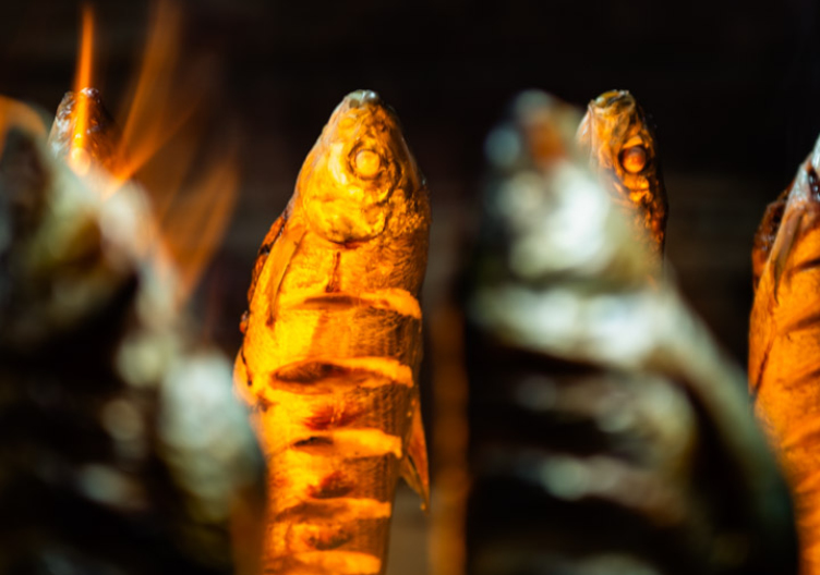
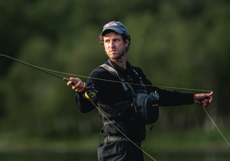
Flyfishing in Swedish LaplandThen you continue west, following the river. Just west of Övre Tväråsel you can go down to the waterfall at Fällfors, which is in fact one of the best fishing spots in Norrbotten. But if it’s rapids you’re after, you’ll soon have your fill.


Storforsen
It’s afternoon already, so you check in to Hotel Storforsen. As soon as you step out of the car you can hear the sound of Europe’s largest unregulated rapids. The Pite River falls a total of 82 metres along these five kilometres, and the final two of them are truly magnificent. Next to the rushing river this popular nature reserve also holds the Dead Fall, glacial potholes and unique vegetation. Storforsen Nature Reserve is also partly prepared for visitors with functional diversity.
Also read
Sweden's national parks


3. Storforsen–Jokkmokk: 110 km
After a morning walk to the rapids and breakfast, you continue inland along what is known as the Midnight Sun Road. From Storforsen you choose route 374 and follow the tributary Varjisån. The distance from Storforsen to Jokkmokk is just over 100 kilometres. You decide to slowly make your way up to Jokkmokk, or Jåhkåmåhkke as it’s called in Lule Sami. Route 374 on the way to the E45 consists of forest, cultivated forest, wetlands and every now and then a glimpse of water. In Kåbdalis remains of the winter snow glitter like little white clouds on the ski slopes. The season is no further away than the first frost. In Tårrajaur there’s space to park along the road, which is also the case at the Arctic Circle just south of Jåhkåmåhkke, Jokkmokk.
Also read
The mountain flora
Swedish Sami Museum
Ájtte is the Swedish Sami Museum, the principal museum on Sami culture, a specialist museum for the landscape and culture of the mountain region and an information centre for mountain visitors.
Jokkmokk
This town is most known as the setting for the Jokkmokk Market, organised every winter in the beginning of February since 1605. This is in many ways a main town in the Swedish part of Sápmi, the land of the Sami. It’s easy to spend a day or two here, visiting Ájtte, the Swedish Sami Museum; Fjällträdgården, the alpine botanical garden as an entry into Laponia, Duodji, the Sami craft shop and knowledge carrier; Stoorstålka, another shop with a modern character, with a wide variety of yarns and amazing knitting patterns; Jokkmokks Tenn with a rich history and beautiful pewter products and Care of Gerd, skin care products featuring local products and a brand that has become an international success. There are plenty of accommodation options – you can stay at the camping site, at Jokkmokk Hotel, or in the floating rooms at Peace and Quiet Hotel – but tonight you have chosen classic Hotel Akerlunds, next to Norden cinema and across the road from the outdoor seating of Krog Lokal.

4. Jokkmokk–Kvikkjokk (Årrenjarka) 120 km
Just north of Jokkmokk – after you’ve passed the power plant Akkats, featuring paintings by Lars Pirak, Lars J:son Nutti and Bengt Lindström, and the parking lot Laponia by Haraudden – the road turns west towards Kvikkjokk, Sarek National Park and World Heritage Laponia. The road now follows the dammed Lesser Lule River the entire way. In Tjåmotis there’s a well-known exit road to the bridge across the Sito River, where many start their hike towards Aktse, the Skierfe cliff and the Rapa Valley views. The road continues to Kvikkjokk, a renowned STF mountain station since 1928.
Also read
The midnight lightKvikkjokk by lake Saggats has a rich history. Mainly in a Sami context, but it was also visited by both Linnaeus and Olof Rudbeck the Younger for botanical studies before the site became popular through the tourist organisation STF and the King’s Trail hiking route. Kvikkjokk is a starting point for those who want to reach into Badjelándda and Sarek national parks. The King’s trail passes through a gateway in the mountain station, designed by architect John Åkerlund. If you don’t feel like walking to the Rapa Valley there are helicopter tours with both Fiskflyg and Kallaxflyg from here. In the evening you have booked a meal and a stay at lovely Årrenjarka mountain village.


Laponia, with Sarek och Badjelánnda
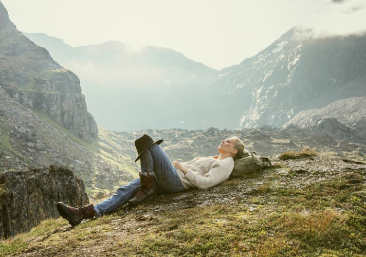
Laponia is a Swedish World Heritage and one of three World Heritage Sites within the destination Swedish Lapland. Laponia was added to the World Heritage List already back in 1996, listed for both its cultural values and its natural values. Very few World Heritage Sites have this dual status. Laponia is Europe’s largest continuous natural landscape, and largely the only human activity here is carried out by the Sami. This is their cultural landscape where they live their nomadic lifestyle, following the natural migration of the reindeer. Sarek contains several of Sweden’s higher, 2,000-metre mountains, and offers a truly alpine Arctic environment.
Also read
Padjelanta — The higher groundResearch has been carried out here for a long time, Linnaeus and Rudbeck the Younger were mentioned above, and geographer and geologist Axel Hamberg also deserves a word or two. One of the houses he designed can be found at the mountain garden – Fjällträdgården – in Jåhkåmåhkke. Badjelándda, Padjelanta, means the High Land in Sami. The trail Padejelantaleden, perhaps starting from Staloluokta or Consul Persson’s cabin, is classic Swedish hiking. Not least if you’re interested in mountain flora.