Sweden’s most famous hiking trail, Kungsleden, initially went from A to A. From Abisko to Ammarnäs, or vice versa. It was not until 1975 that the trail was extended to go past the King’s fishing spot at lake Tärnasjön in Sorsele municipality as well, and on to Hemavan. The Swedish Tourist Association (STF) began working on the King’s Trail back at the turn of the last century. In the STF yearbook from 1900, you can read about it, marked on a map: “This will become the King’s Road through the Lapland mountain world”. 75 years later, it was all ready to go, and in 1977 the trail became part of the state mountain trail system. But it was not a case of STF creating a brand-new trail for the state system – there were old hiking trails joined together to create a ‘royal vein’ through the mountains. Indigenous people and others walked here for thousands of years before anyone came up with the idea of a signposted trail.
These days, the stage between Abisko and Nikkaluokta is the most hiked trail in all of Sweden. The stage Abisko to Hemavan also gets a lot of visitors, but between Ammarnäs and Jäckvik, there are not quite as many who wander. And between Jäckvik and Kvikkjokk, it mostly comes as a surprise if you come across other hikers. But you are not alone. There is history here and nature: other cornerstones of human life.
The King’s trail
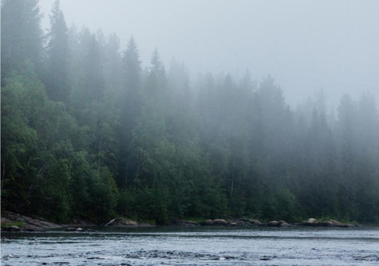
Kungsleden runs from Hemavan to Abisko in the Swedish mountains. The 450-kilometre long trail will take you through the Vindelfjällen nature reserve, the Laponia World Heritage, four national parks and the headwaters of Sweden’s four remaining national rivers. This is the most beautiful hike up north, covering some vast and wild land.

A dream of freedom
“The path is made in the walking of it” – Zhuang Zi.
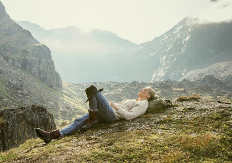
A hiking trail, what is it – really? For most people who set off on a hike, or even a ‘thru-hike’ of the entire King’s Trail, there is a dream of freedom. But as you find yourself on the high plateau at Stabburet above Ammarnäs, with large swathes of Vindelfjällen nature reserve – one of the largest in Europe – in front of you, you realise that the trail does not provide oceans of opportunities at all. Instead, the trail reduces your flow of opportunities to a trickle: if it had not been for the path you are walking, you could have chosen a billion different options where to put your feet. As Zhuang Zi wrote: “The path is made in the walking of it”. What you dream of as freedom is the choice of the collective, in a way. Simply because it is the right way to go. Ideally, a path works as a helper, someone who discreetly shows you the way as the world just opens up. Surely that is why the path or trail in literature, philosophy and religion has always been a metaphor for man’s inner guidance.
Zarathustra spoke of the threefold path: good thoughts, good words and good deeds. Siddhartha Gautama spoke of the eightfold path to nirvana. Tao basically means trail. The Hebrew word for Jewish law, Halakhah, means the walking, and the Islamic law, Sharia, can be translated as the path to water. The Bible is, of course, also full of stories about people taking the path up the mountain or through the valley of the shadow of death. The Psalms state that the word is “the lamp unto my feet and light unto my path”. But on your way between Kvikkjokk and Saltoluokta, it is not very likely that you will be struck blind by a light and converted like Paul, even if you are walking in the midnight sun. The most important thing is that you stay on the road and keep walking. Because on the King’s Trail, a spiritual path is not much more than the ground in front of you, worn clean down to rock, gravel and dirt. Something you put your feet on because you want to get from here to there – because possibly you will encounter your new interpretation of things, something that will make you see the world as a little bit more beautiful.

The Vindelfjällen mountains
The Vindelfjällen mountains is one of Europe’s largest nature reserves; allegedly, there is one somewhere in Russia that is larger. The King’s Trail runs like an artery straight through the reserve, from Hemavan towards Arjeplog and Norrbotten. When you have hiked the first 100 kilometres between Hemavan and the Norrbotten border, you have walked through two municipalities, and there are four municipalities to go through before you get to Abisko. Ludmilla Wieslander works at Naturum in Ammarnäs. She is from Lund, in the very south of Sweden, but came here for an Easter break and her heart stayed put. First at the bar at Ammarnäsgården with a handsome man, then in the beautiful location itself.
— Yes, to me, Ammarnäs is the very heart of Vindelfjällen. The day-trail loops and the two big trails, King’s Trail and Vindelvaggeleden, like two massive blood vessels through the reserve, they all start from the village in one way or another.
— The nature is amazing, this place is stunning, and in the middle of all this, the beating heart: Ammarnäs.
As stated, the Vindelfjällen nature reserve is large, and its preservation is based on many different things. This area is not just about hiking; it is also home to some of the finest bird watching in the mountain world. The University of Lund runs one of the world’s longest-running bird-observation projects here: the Luvre project. Every year the red-listed lesser white-fronted goose visits the village for a stop before the birds fly into the mountain world. The reason for the Luvre project and other nature projects in the area is that the nature in Vindelfjällen changes on nature’s own terms. Even if it is not a wilderness per se – people have lived here for 8,000 years – it is a cultural landscape that changes very slowly. It is difficult to talk of a wilderness when hiking on a trail equipped with footbridges and marked with cairns. But there is something enchantingly wild and beautiful about the seemingly endless landscape. As if it should always be like this because it has always been like this.
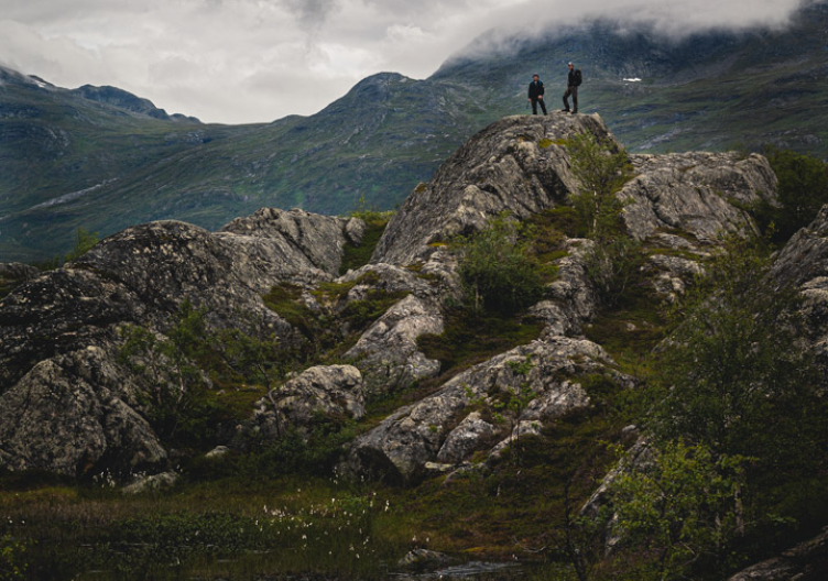
It is only really the wind itself that has explored this landscape, everything in front of you, in detail.
In 1949 Aldo Leopold wrote his classic book A Sand County Almanac. It begins: “There are some who can live without wild things and some who cannot”. No one has really explained it better, why some walk, fish, go out into the woods – and why others do not. Without the dream that the wild is needed, there is no need to go looking for it. Perhaps it is as simple as that – two types of people: those who are looking for nature and those who are not. Somewhere above Ammarnäs, some fifty metres from the King’s Trail with the Björkfjället mountain behind you and Arjeplog municipality and mountain world before you, you set up your tent and ponder the fact that there are just over 300 kilometres left until you reach Abisko. The King’s Trail will guide you step by step along the way. The area in front of you has basically been the same since the end of the ice age, and in this kind of nature, the process of evolution is a matter of course. No plants grow here without reason, merely to decorate the landscape. If they are able to grow here, they grow where they can, to feed the animals who need the plants that grow. In many ways, this is a place defined more by body than soul. You have to be strong to get somewhere; just thinking about it is not enough. It is only really the wind itself that has explored this landscape, everything in front of you, in detail.

Paths
A path is created based on a need. The easiest way to discover this is among city blocks. People will not follow a paved path if it fails to support people’s need. Between walkways drawn by city architects, nature paths are shaped by people’s laziness, and these so-called ‘desire lines’ will soon create short cuts and simplifications. Our feet understand this; the pen being traced across the drawing board does not. The new routes become a graffiti of the feet, protesting against what the authorities believe they drew and planned. No trails are drawn on the mountain. From the beginning, human feet followed paths created by the hooves of animals, then those feet made their own short cuts, and the path became more and more defined. Not just as a thought – a King’s Trail from A to A – but a reality. In Japan, these paths are called kemonomichi, animal paths, while the Dutch have given the animals a persona in olifantenpad, elephant paths. What is clear is that if a hiker walks a path and other hikers find it worth following, the collective will make the path better and better, together, or at least more adapted to the hiker’s needs.
Stages
Along the stages between Abisko and Kvikkjokk, and Ammarnäs to Hemavan, there is a well-developed cabin network. Between Kvikkjokk and Ammarnäs, on the other hand – the least-visited stretch of the trail and perhaps the wildest part of the King’s Trail – there is a lot more distance between cabins and service points.
The hike between Abisko and Nikkaluokta is the most alpine stage and the most-hiked trail in all of Sweden.

Roadless land
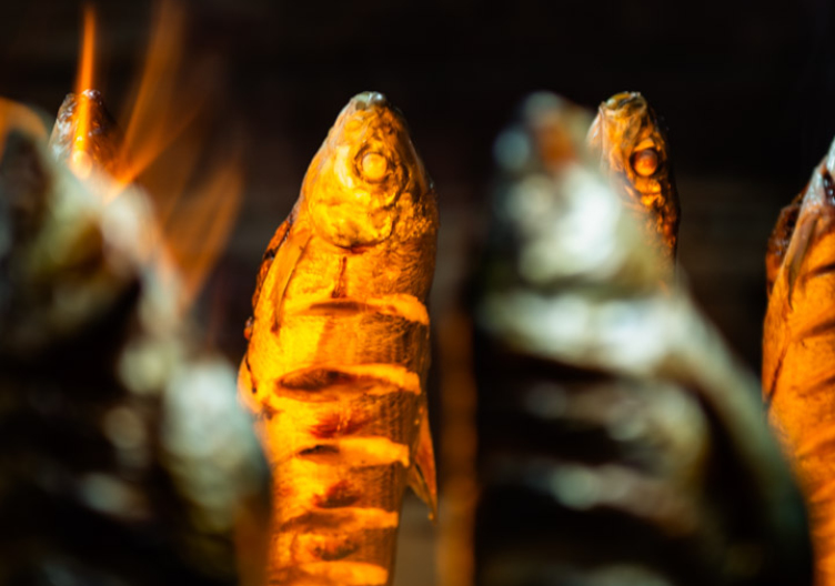
Roadless land. That is what it is called, beyond the car park. But in the middle of this roadless land, there are some really big surprises. A place to sleep, a shower, a sauna and a cold beer with your meatballs at Bäverholmen Inn. Or Janne picking you up by boat in Vuonatjviken, and then you decide to stay there for dinner. Everything is basically as locally produced as it gets here along the Arctic Circle by the family that has lived here – beyond the highway – for several generations. Elk, arctic char, reindeer and cloudberries. Nature’s pantry around the corner. It is impossible not to think about how tough it must be to live like this, in isolation.
– You don’t forget to buy sugar more than once in your life if it’s sugar you wanted. There’s such a long time in between shop visits, says Janne and continues:
– But, as I’m sure you understand, our needs are different, and it would have been a lot tougher for us to live in the city. We have no traffic jams here, and the problems are completely different. We mostly choose those problems ourselves – as long as they’re not caused by nature.
Since restaurants are few and far between in roadless land, you have a three-course meal this evening before the trail leads you further. Alone.
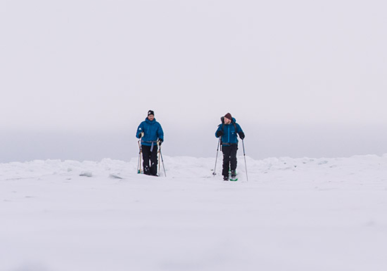
There are questions you will always ask yourself as a hiker. It is about the physical person as well as the inner person. About blisters and doubts. They say you only start feeling like a proper hiker on the tenth day. That is when your body starts to feel like it is made for it. It is not an obvious or easy thing to manage ten days in a row on the trail. Some have the feet for it. Others do not. “A woman is as young as her knees”, wrote Mary Quant, and Polish philosopher Stanislaw J. Lec wrote, “He who limps is still walking”. The main thing to overcome is the comfort of the sofa. Another question that always comes up is whether you should hike on your own or with someone else? From a safety perspective, it is better not to go on your own. But perhaps it is safety you want to get away from? An Irish proverb says that “two shorten the road”, while Henry David Thoreau crassly states that “the man who goes alone can start today”. When Jeremias and Hannah, from Northern Soul Journeys, trotted along the whole King’s Trail a few years ago, they did so as a new couple. They also decided that they would each carry a part of the essentials in their packs, so they had to do things together when the day was over. No one carried the whole tent or the entire kitchen; they had to make camp together for the night. There is something very beautiful in that thought.

Food
Food occupies the mind of many hikers. Dreaming of what will be on the plate when the hike reaches the end of a stage or is finished, even.
— If you ask me, you get the best burger at Topprestaurangen in Hemavan, but the suovas-smoked burger at Guidecenter in Ammarnäs and the burgers in Saltoluokta are tasty, too.
Jeremias Kinnunen at Northern Soul Journeys likes to talk about the burgers he has eaten along the King’s Trail. A couple of years ago, as said, he wandered along the entire length of the green ribbon with Hannah, but it is the burgers of the King’s Trail he remembers when we ask him about the experience. And his favourite stages, of course.
– It is a bit strange, but the trail between Ammarnäs and Jäckvick is one of the least hiked stages of the King’s Road. But it is amazingly varied and beautiful there, walking down Björkfjället mountain through Stijguojá, across Pieljekaise national park towards Jäckvik.
– It’s as if the King’s Trail has everything right there. Even some burgers.
– You can definitely tell the difference between a thru-hiker and someone who’s only here for day trips and food, says site manager Elin Strannegård at the STF mountain station in Saltoluokta.
– You can tell from the hunger and the packing. They have a lot of the first and a little of the second.
Saltoluokta has become a luxurious destination along the King’s Trail. It is easy to get here, travelling by car and boat all the way, and there is an incomparable view of Lake Langas and Stuor Muorke national park in the ambitious restaurant. This is why Saltoloukta gathers lovers of life and mountain veterans in a great mix. You can feel it when you leave the mountain station behind, that you really wanted to stay.
Season
The summer season begins in June and lasts until mid or late September. During this time, there are cabin hosts at most cabins. The distance between cabins varies but is usually between 12-15 km, a fairly comfortable days stage.
Hiking the King’s Trail does not have to be a hike with heavy rucksacks and long stages. You can buy food at most cabins during the time of year they are staffed, and if you plan ahead, you can do a ‘light-weight hike’. In general, good planning always makes trips like these easier.

Sápmi
Along the trail, you pass some of Sweden’s most famous nature areas, as is to be expected. We have already mentioned the Vindelfjällen nature reserve, but the national parks Pieljekaise, Sarek, Stuor Muorke/Stora Sjöfallet and Abisko are also part of the trail. These four national parks were involved when Sweden, as the first country in Europe, set aside land for nature conservation on May 24, 1909. Sarek and Stuor Muorke has since been joined with Padjelanta and Muddus national parks to create Laponia, which due to its unique nature and culture, was designated a World Heritage Site in 1996 by the UN agency Unesco. Along the entire length of the King’s Trail, you are hiking through Sápmi, the indigenous people’s land. On the trail between Hemavan and Abisko, you walk through the reindeer grazing land of fifteen different Sámi communities. In some parts of the year, calf branding takes place in the mountains. During other times of the year, reindeer are gathered for other purposes. Always be considerate and remember that you are in the middle of Sámi everyday life and at their workplace. In summer, newly born reindeer calves do not need to be stressed for a selfie; it is difficult enough for them already in a land that is only truly known by the wind.


One step at a time
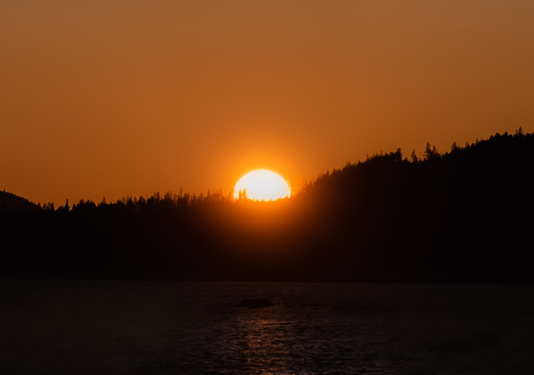
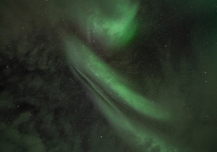
Sooner or later, we will all hike to Abisko. It is the most popular stretch of the King’s Trail, especially with the detour past Sweden’s highest mountain: Kebnekaise, and on towards Nikkaluokta. The King’s Trail, the original one, does not really pass the Kebnekaise mountain station. It keeps its ambition from A to A. But the trail from Abisko to Nikkaluokta, or vice versa, is also a trail of pilgrimage. The words that you find on the path are written by the former Secretary-General of the UN, Dag Hammarskjöld, who wrote the magical book Markings. The first quote: “The longest journey is the journey inwards”, is a true classic, and the idea is probably that you have to learn to live with your blisters. Once you are on the trail, it takes time to get into the rhythm and to understand that it is one step at a time that takes a hiker further. Nothing else. As you arrive at the path, leaving the highway and modern society behind, it will take time to understand that this is actually how your brain works best: in harmony with nature, on the road, on foot. Perhaps this is one of the most difficult things to accept, that our senses are made to work best on foot. But if you manage to do it, you will also experience the magic of being in the present. It is you and your camp, and a starry sky clearer than you have ever seen it before. Simply because you have never had time to look for it. Tomorrow everything will be different, but right now, you are here.
Learn more
In the 1920s, the first stretch from Kvikkjokk to Abisko was cairned, and today the King’s Trail stretches some 430 kilometres from Abisko in the north to Hemavan in the south. There is a well-developed network of mountain stations and cabins, making the hike easy and fun in summer as well as winter.
STF has a lot of information about the King’s Trail, all the cabins, what to pack in your rucksack and ideas for children along the hike. You can find all this at swedishtouristassociation.com.

Suggested tours along the King's Trail
Abisko–Nikkaluokta
Distance 105 km
Days 5–7
Number of STF cabins 5 on the King’s Trail and 7 nearby
Provisioning Abisko, Abiskojaure, Alesjaure, Kebnekaise, Sälka, Vistas, Unna Allakas
Sauna Abisko, Abiskojaure, Alesjaure, Kebnekaise, Sälka, Unna Allakas, Vistas
At the Singi cabins, you can veer o the King’s Trail and head towards Nikkaluokta via Kebnekaise mountain station, or keep going south towards Vakkotavare. To follow the King’s trail south from Vakkotavare you take a bus to the pier at Kebnats and a boat across to STF Saltoluokta mountain station.
Kebnekaise–Saltoluokta
Distance 52 km (bus from Vakkotavare to Kebnatsbryggan/Saltoluokta)
Days 4–6
Number of STF cabins 4
Provisioning Kaitumjaure, Kebnekaise, Saltoluokta, Vakkotavare
Sauna Kebnekaise, Saltoluokta, Teusajaure, Kaiutumjaure
Saltoluokta–Kvikkjokk
Distance 73 km
Days 4–6
Number of STF cabins 3
Provisioning Saltoluokta, Kvikkjokk, Aktse
Sauna Saltoluokta, Kvikkjokk
Boats are available to borrow where you need to cross lakes, or you can ask for a lift. There’s information on the internet, so do a search for ‘STF boats in the mountains’. Keep in mind that certain parts of the trail have no mobile coverage, so call ahead to book.
Kvikkjokk–Ammarnäs
Distance 157 km
Days 7–10
Number of STF cabins 0
Provisioning Kvikkjokk, Jäkkvik, Adolfström and Ammarnäs
Sauna Kvikkjokk, Ammarnäs
The King’s Trail between Kvikkjokk and Ammarnäs is more demanding than other parts of the trail. This part of the King’s Trail is not equipped with cabins and shelters, so you need to bring a tent and other necessary equipment.
Ammarnäs–Hemavan
Distance 78 km
Days 5–7
Number of STF cabins 5
Provisioning Alla stugor. Aigert, Serve, Tärnasjö, Syter, Viterskalet and Ammarnäs and Hemavan
Sauna Ammarnäs, Aigert, Tärnasjö, Hemavan